
My wife, Jennifer, had a training conference in Troy, NY related her work, so I decided to go along and take the road bike for some riding on some of the paved trails in the area.
Specifically I was interested in the Mohawk Hudson Bikeway, which various websites mentioned as quite long.
The link to the left is the official site from what I can tell, and has trail maps. There are also many other good sites about it, like this one from the County of Schenectady. It also has links to a different set of trail maps.

I was looking forward to the ride in a new location, as I am getting a little bored of riding the same roads here in Jefferson County that I have ridden my entire life. Now that I’m riding longer and farther I find myself riding quite a distance just to travel on a new route to explore. Occasionally I load my bike into the car to ride to new places, just for a change.
Unfortunately after I bought my Honda Accord coupe I found that my bike carrier wouldn’t fit over the spoiler. Argh! To fit the bike into the car I need to detach the front tire and seat – a pain in the ass to be sure. At some point I will need to find a new carrier but that brings it’s own potential problems – putting one on the car is a bit of trouble in general, but mostly I worry about the little scratches it can put on the trunk and back of the car/bumper. On my last cars I padded it up real well just to make sure.
So anyway, this trip was going to be a nice change for a day’s ride. Like I said – I was really looking forward to it. Especially since I could pretty much just throw the bike into the back of my wife’s brand new Ford Edge.

A little about the Edge here, as it’s a good all-around vehicle but also great for outdoors people. Neither of us has had a Ford before but this vehicle seemed to fit my wife’s needs for an SUV, replacing an aging Pontiac Aztek.
I know, people hated them, but we loved it because it was such a general-purpose machine – we used it as everything from a weekend car, work vehicle, truck, camper, truck/trailer, drive-in theater tailgating vehicle, dog transport, etc. Trying to find a replacement with the same features and interior volume was nearly impossible.
But the Edge very closely fit the bill, and has an incredible number of options and technology that we enjoy – everything from a built-in GPS, full hands-free system for controlling the functions of the vehicle, to AWD with stability control and a large interior space with seats that fold down nearly horizontally to make a level space for the dogs to ride in (amazingly a lot of vehicles don’t have seats that go as nearly horizontally as this one does).
So enough advertising for Ford products. So far we seem to be pretty happy with it. Time will tell. And my bike slides inside easily with lots of room for luggage. I did end up taking the front tire off and sliding the front fork in on top of an old blanket just so I could tilt the bike to the side more, giving us the entire left side of the rear of the vehicle for our luggage, workout equipment, cooler, laptop case, and my biking stuff. This also allowed he bike to rest with less pressure against the handlebars and seat, so nothing would get scratched as we drove, or vibrate.
The trip down was uneventful and the day was pretty nice and warm. Neither of us really enjoys the air conditioning much so we cracked the windows a bit and had a nice trip.
The hotel, the Fairfield Inn in East Greenbush was quite good, one of the best I have stayed at. The next day we had a huge continental breakfast, courtesy of the hotel, and after checking the weather a few times we headed out. Jennifer brought her running clothes so she could run during the lunch hour break, but we both hoped the iffy weather would stay nice for our respective planned outdoor activities.
After dropping her off at the college where the training was being held I headed back to the hotel, trying to decide what I wanted to do. I wanted to get a little work done at the hotel on my laptop, since the hotel had such a high-speed broadband connection and I could take as much time as I needed because of the noon check-out. But from a quick check of the weather sites it looked like a storm was heading in so I wanted to get out for some biking as quickly as possible. I gathered up my stuff, packed the car, re-checked the room, and checked out.
Unfortunately I hadn’t properly read the maps to see that some of the Mohawk-Hudson Bike/Hike Trail in certain parts of its length are actually just following the streets. From one of the little maps that I had grabbed I couldn’t tell that the trail was actually following streets and they’re actually not very long sections that are not dedicated trails but I happened to start searching for those section because they were fairly close.
I burned a lot of time and some precious fossil fuel driving to different locations, of which I didn’t want to ride from as they were just plain streets. A few were small park areas where I ended up getting my bike out, putting the tire back on and riding to the end of a park a few hundred feet long, and finding it exiting onto another street system riding back to the car to take the bike tire off and pack the bike back in. After about the fourth time I had enough of pulling the bike out and putting it back into the Edge.
And I gotta say it again – the GPS is a life-saver. Trying to do this with a paper map would be hard and probably dangerous, but having a GPS is such a relief in unfamiliar areas. I got myself in some questionable places while searching for better trail heads but could get myself out quickly and efficiently with the built-in GPS. There was one place where there was a lot of yelling, screaming and a crazy-bad neighborhood where I had stopped in to check my iPod maps. But I was out of there instantly and without getting lost with directions from the GPS. Indispensable.
So I had a lot of frustration and only after referencing maps on my iPod Touch and comparing them to the GPS maps on the car (I found that one map that I had downloaded off one of the sites didn’t have a major highway on it, which really messed me up for a while – something to watch out for if you check out the above map links) I found the stretch of trail that goes into Albany uninterrupted by roads or streets.
[dropshadowbox align=”center” effect=”raised” width=”160px” height=”” background_color=”#ffffff” border_width=”1″ border_color=”#dddddd” ]Watervliet Parking Area[/dropshadowbox]

Schuyler Flatts Cultural Park
There’s really no signs to the little parking lot in Watervliet, where the trail goes from on-road to the off-road paved trail all the way to Albany. Look for Broadway (Street?) in Watervliet. The road to go to the parking area is across from 4th Street on Broadway and you’ll see an underpass to go through.
Also, I am going to mention here first – as you go down this little street look immediately to your right and there is another black-topped trail near the corner and before the underpass, this fairly trail is short and leads to Schuyler Flats Cultural Park (it continues past the park a short distance to a dead-end). This is a nice little park that this separate trail leads to and the park itself has a paved trail circumnavigating tit. You can also see some native american cultural signs and such here too. There’s some remnants of the old Erie Canal here too, kind of a large depression in the ground. Nice little park to visit.
On to the Mohawk-Hudson Trail parking itself. Through the underpass there is a good-sized parking lot. The parking area seems to be well-used by people parking to use the trail as well as those who are fishing there. There’s some benches, and such. No restrooms/porta-potties while I was there.
[dropshadowbox align=”center” effect=”raised” width=”225px” height=”” background_color=”#ffffff” border_width=”1″ border_color=”#dddddd” ]Mohawk-Hudson Bikeway/Hiking Trail From Watervliet to Albany[/dropshadowbox]
 The entire trail system of the Mohawk-Hudson Bikeway/Hiking Trail goes from the hamlet of Pattersonville in the town of Rotterdam to the Erastus Corning Riverfront Preserve in Albany, near the Capital district. The part that I traveled was from the this parking lot to the end in Albany and is around six miles over-all, five and a half or so to the Erastus Corning Riverfront Preserve. It then continues through the preserve and a short distance more. The trail is considered part of the state-wide canalway trail that roughly follows the old Erie Canal from there to Buffalo.
According to various websites this trail was built in the 1970’s through the 1980’s and tries to follow the route of the Erie Canal towpaths and the Schenectady and Troy Railroad beds. In total it’s thirty-five miles long, though not a continuous trail. In the city of Schenectady and in Rotterdam Junction it follows streets instead of being a dedicated trail. There does seem to be a few other places too. As I found out.
The longest uninterrupted section is in Schenectady County at twenty-five miles long. The section I rode on was from Watervliet to Albany, around six miles in total as I mentioned above.

Ruins on the other side of the Hudson
And I actually rode this part of the trail twice. After the first time through I had a small lunch in the parking lot and went in search of a few other trails. They were okay but nothing I wanted to ride on, either because of their short lengths or because the trails were dirt or gravel (not so good for riding on with a road bike) or because I didn’t feel comfortable leaving the car in a bad area (like the one end of the Uncle Sam Trail in Troy – probably the other end was better but I ran out of patience to look any further).
This section of the Mohawk-Hudson Trail that I rode on was beautiful, with a nice paved blacktop and only a few wavy places, and mostly quite smooth. The day itself was pretty hot and muggy but there were a number of people walking, running, biking, or walking their dogs on the trail on the Tuesday that I biked it, despite threats of storms.

As I rode I could see painted lettering on the blacktop in places – signs of various runs and/or walks they must have had along the trail.
The Hudson River was on my left, and for a good portion of the trail it was visible. On the right is either trees/woods or the main highway, which in some places is quite close to the trail. There’s a few access roads along the way that I could see that people used, and the trail passes under a number of bridges and exchanges, one bridge of which has a long winding switch-back ramp leading up to a pedestrian/biking walkway that crossed over it. The ramp is quite steep, for a challenge on the second ride I rode up it, checked out the pathway and rode back down. The path across this long bridge isn’t very wide but I would have went across the bridge, except I felt that that was something to try on another trip.
The river had a number of boats, big and small, traveling it, and occasionally I could see buildings and structures on the other side, including some of the remains of old buildings and things that may have been related to the canal system. See the photo above-right – small water level doorway on the other side.

Halfway to Albany
And speaking of photos…I wanted to mention that while I have an uber-nice Canon Rebel EOS – the Rebel not something I would normally carry with me on a biking trip. It’s expensive and fairly large and really not needed for the occasional shot like the ones I have included here. I use a Canon Powershot A570 IS, one of the best small point-and-shoot style cameras made I think. The funny thing is that it is considered point-and-shoot yet it has some very advanced features on it, and with the CHDK hack on it it is even better. There are so many almost-professional options on it, especially with CHDK, that you might be overwhelmed Great camera, I have taken thousands of photos with it. What do they say – the best camera is the one that you have with you?
I was a bit surprised about some of the people on the trail. I guess my surprise springs mostly from growing up and living in a small area of population. You meet a stranger here on a trail and most everyone has a wave or a hello for you. Even in Syracuse on places like the Onondaga Trail people are much friendlier. But while riding on this trail very few people acknowledged my own waves or head/helmet nods or hellos. In fact a number even turned their heads away right before getting close to me, or even did so as I nodded to them. I’m not the most people-oriented person but it seems strange to me, the unfriendliness of the people on the trail. A minor thing for sure, oh little consequence to my enjoyment of riding the trail but of interest to me nonetheless. A different city, a different area, much larger than here, and different attitudes I guess. I can count on my hands the number of people who did acknowledge me, like the pair of elderly gentlemen runners and surprisingly a number of younger people seemed more likely to say hi, etc. Not even those who looked like serious bicyclists, what I consider a brotherhood of stoic enthusiasts but usually ready to acknowledge a fellow biker with a wave or helmet dip, returned my helmet nod. Even more unusual for that to happen. Anyway, just a side anecdote to add here and back to the trail…

Getting closer to Albany
As you can see in the photo above I came out of a stretch of trees to see the skyline of the city ahead of me. What a great view.
In the photo you can see on the blacktop some painting with a distance number or something, obviously from a previous run or walk of some kind, or maybe even a bike race. I saw this here and there along the whole length of the trail.
As I mentioned before it was hot and muggy but what a great day for a ride. Despite the heat I was flying, making excellent time, and I felt great being on a dedicated trail like this. Though my overall times and speeds (according to the GPS watch) were terrible because I was making so many stops for site-seeing and pic, but I didn’t mind that. And the cool air felt good in contrast to the heat of the sun. After getting in damn fine shape the last few years I find that I don’t mind the heat very much, perhaps my body is more efficient at cooling now or maybe it’s just the lack of all of that insulating fat. Whatever it is it feels nice to get out in the heat, and do some intensive exercise.
I was passing slower bicyclists, runners, and walkers; always being careful to let them know that I was going to pass them if needed and slow down just in case they made a wrong move. The little bell on my bike came in handy a few times but people still seem to respond better to “On your left!” or something along those lines – though there’s the occasional dummy who actually takes a step to the left when I say that so I always have to be careful.
[dropshadowbox align=”center” effect=”raised” width=”235px” height=”” background_color=”#ffffff” border_width=”1″ border_color=”#dddddd” ]Erastus Corning Riverfront Preserve[/dropshadowbox]

Erasmus Corning Riverfront Park, family of tame geese in the park
The Erastus Corning Riverfront Preserve is what is a called a ‘linear park’ (according to a website about it) – it’s long and thin and parallels a major street. It’s a nice little park with the trail meandering through the middle of it, some branch trail or sidewalks off to the side, a little stream through part of it with a bridge over it, and various paved paths leading out of it and into the surrounding streets. There’s fishing access, a playground, picnic areas, benches, and picnic tables as well as free docks and in the summer there are concerts. It’s quite a long park, as I mentioned, but you wouldn’t know it from exploring it. It stretches to just below the Troy Lock and Dam.
There were a lot of people of all sorts using the park for all kinds of things, including walking, running, biking, sitting, having lunch, and walking their dogs. It looked like a favorite place for people to get out of their offices and take a stroll too. And I also noticed what looked like a homeless woman with a shopping cart packed with her belongings, though many of them were spread out over the picnic table she was occupying. She was somewhat frantically and quickly filling a journal with writing. As I passed nearby she flipped a page and continued on with the next one, writing quickly and fluidly the whole time, without pause.
BTW, Erasmus Corning whom the park was named for, was a well-known business person in the Albany area during the 1800’s and was mayor of the city at one point in his life.

Tour boat docked at park
[dropshadowbox align=”center” effect=”raised” width=”160px” height=”” background_color=”#ffffff” border_width=”1″ border_color=”#dddddd” ]Continuing on the ‘Trail'[/dropshadowbox]

Looking back over the Hudson, one of the many bridges
It’s hard to call it a ‘trail’ as it continues a bit through the city. I think ‘bikeway’, as it’s called on some websites, is a much more apt descriptor.
The path is still wide and marked as a biking/hiking way as it continues past the end of the park.
Here it’s a concrete path, like a sidewalk but wider. Still a great view of the Hudson and the many bridges crossing over it. Part of the trail takes you right along the edge of the water.
Unfortunately, unless you like massive four level interchanges right above your head – and it is indeed impressive engineering – the path now leads under these monstrous exchanges along this ending section.
Cars roar by overhead, construction cranes and vehicles swing nearby as they work, and on the street beside you cars speed by.
If you’re a bike enthusiast, or a runner, it’s still nice to have your own separate path to use but it isn’t quite as relaxing as the rural part of the pathway.

Nearing a bridge and large highway exchanges
Above I am nearing the large exchanges and a bridge, and off to the right you can see a ramp leading up steeply to the top of the bridge where you can continue on a sidewalk along the side. Again, something for next time for me to check out.
A homeless or disadvantaged dude was standing there with a sign as I passed You can see the guy in the picture above, he was clean and dressed in a t-shirt and jeans and was one of the few people who smiled and said hello to me. Just for that I would have considered giving him some change or something but being on my bike I had nothing to spare.


Nearing what looks like the end of the trail

U.S.S. Slater
Near what seems to be the end of the dedicated bikeway, where it just turns into regular sidewalks, is the U.S.S. Slater. This was a Cannon-class destroyer escort that served in the United States Navy and later in the Greek Navy. The ship is now a museum ship and you can take hour-long tours of it for $7. Again, something for another day maybe.
Just past here is a small area with some concessions and such, having to do with the ship, and then the large U-Haul building with the spinning full-size U-Haul truck on the top. Right about there is when the bikeway turns into regular sideways from what I can tell.

The spinning U-Haul truck on top of the building
This is where I turned around and headed back. On the way I went up the long steep ramp a little ways that leads to the top of the bridge, seen in a photo above. I didn’t go all of the way, thinking I would do it some other time.
I was a bit sad that the trail wasn’t longer, but I still had a great ride back (seeing the homeless woman still writing in her journal as quickly as she could as I went back through) and I took a slightly different short path through part of the park to see some more scenery. Again, moving along at a great clip, not having to worry about traffic, much in the way of hills, nor traffic signs was such a relief and change after so much road biking in the last few years – slowing down only to pass people. Though my times weren’t so good – I was traveling fast, but stopping often to take photos and site-see.

In this shot you can see how closely the highway comes to the trail at this section

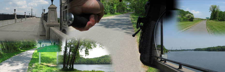
Bike Perspective Photo
Back at the parking lot I packed my bike back in the Edge, had a small lunch, finished a coffee and the rest of my water and cooled off a bit while I planned which trails I was going to check out next. Again, I wasted some time traveling around the neighboring metro areas and decided to finish up my day by doing this same ride over again, even though it was relatively short (riding around the neighboring park and as many side places as I could go I managed to squeeze out fifteen miles on my first ride here, about the same the second time through) I liked it so well I couldn’t resist just doing it again.
[dropshadowbox align=”center” effect=”lifted-both” width=”210px” height=”” background_color=”#ffffff” border_width=”1″ border_color=”#dddddd” ]I Liked It So Well I Rode It Again![/dropshadowbox]
Again, returning to the parking area I got my bike out, biked the small nearby park and then headed back to Albany again. There were even more people now as it was later in the day, but even hotter and muggier. Storm clouds were gathering on the horizon.
I passed a number of runners who were taking breaks, including one guy sitting on the pylons of an overpass, his eyes closed and his head almost between his knees as he slowly wrung the sweat from his t-shirt. I very nearly stopped to ask if he was okay because he looked so overheated, and a bit out of it.
A few miles further on a guy on inline skates, pushing a double jogging stroller with twins in, it waved at me. I barely raised my hand quickly enough as I was so impressed with his ability to skate that fast while pushing two kids and a stroller in the muggy heat of the later afternoon.
As I neared the city the sky began to darken quickly, and ominously. I was determined to finish my ride and ride as far as I had before, maybe even exploring a few side spots before heading back. I gauged the speed of the storm and decided that I could make it back at a fast sprint before the storm moved in and caught me.
Amazingly I passed the same homeless woman again, still writing in her book.
Shortly I got to the end and turned around at the U-Haul place once again, and took a slightly different part of the trail through the park, going over the Hudson River Way Pedestrian Bridge. I assume I could ride over it as there were no signs saying that I couldn’t. And it was certainly wide enough to accommodate a couple of cars side-by-side, let alone a few people walking and me on my bike. Wow, I would have liked to explore it a bit further and see what all of the names written on the stones were for, and where it went, but the storm was quickly approaching so I took a quick shot (below) and headed back.

The Hudson River Way Pedestrian Bridge
On the way I passed by the homeless woman once again, still writing. I wondered what she was going to do with her journal when it downpoured. I assumed she was prepared.
After a bit I passed a few runners and other people who I recognized from my inbound trip, including the runner who had been sitting at the overpass. He looked done for but he didn’t have all that far to go, at least to get back to the park.
The sky continued to look worse and worse, the storm moving in fast and I wondered if I had miscalculated the speed of the it. I didn’t even stop to take off my sunglasses and stow them as the sun disappeared behind dark clouds. I sprinted the last five and half miles back to the car, though I wasn’t pushing myself as much as I could have. And I was passing bikes and people as carefully as I could but still trying to hold a good clip.
One bicyclist noticed me coming as I came up behind him and he tried to keep ahead of me for a bit. But I passed him as he pedaled as fast as he could, I supposed, he wobbled a bit with an improperly sized or improperly adjusted bike, his knees splayed out as he rode, losing him lots of torque in our informal little race.
Back at the car I saw that I had a bit of time and more leisurely packed the bike and accessories back into the car and relaxed a bit before I headed out. As I did so a few bicyclists rode in but I knew the majority of the people were going to quickly get wet, as I left the parking lot rain started to fall.
Before I could get onto the main highway it had turned bad, and I could barely see anything. I followed a large school bus at slow speed, pretty secure in the size and stability of the Edge but of course taking it very easily. Some people pulled dangerously to the side of the major superhighway, inviting an accident instead of just moving along to find their exit. A motorcyclist passed me just as it started to hail. And hail it did – I can’t remember ever being in hail as large as that and I feared that it might start denting the Edge as I got off at my exit and kept an eye out for car washes or parking garages or something to stop under. But it quickly moved on, as fast as it moved in, and I continued back to the area where I had left Jennifer at the college.
I was lucky (and so was Jennifer as she was able to run at her noon break through the East Greenbush area), and I had an excellent day on this nice trail. And while it wasn’t as long of a ride as I had been planning on – between the short trails, parks, and riding the Watervliet-to-Albany trail twice I was able to pull out a twenty-nine mile ride. Next time I want to try the other uninterrupted trail section which is twenty-five miles long.


